| Area: Chinook Pass |
Hike Type: Views | Pass: Northwest Forest Pass |
| Distance: 7.5 mi RT | Duration: 5-6 hrs | Difficulty Level: Moderate |
| Elevation Start: 4,443 | Elevation End: 5,633 | Elevation Gain: 1,080 |
| Snow-Free: Late-May – Late-Oct |
-
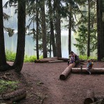
- Camp at Lake Eleanor

-
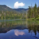
- Lake Eleanor

-

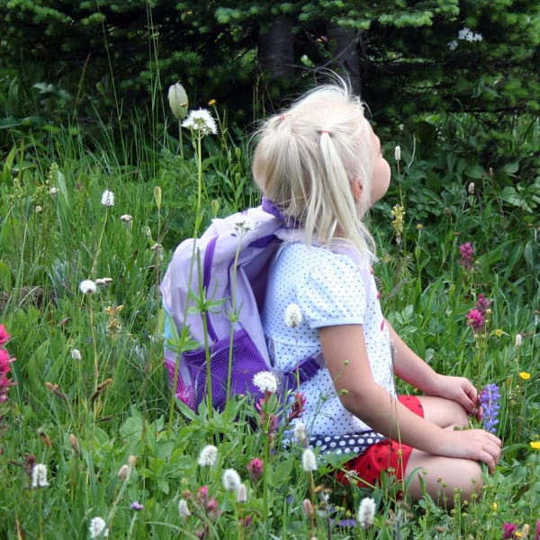
- child in meadow2
As fall turns to winter in the higher elevations, Mt. Rainier National Park begins the process of preparing for the winter season. For hikers, many trails become inaccessible due to road closures and snowfall. But all hope is not lost, there are still accessible trails available for your hiking pleasure after many roads have closed. Come visit the park, as in Grand Park…through the back door. The trailhead for this little gem is off FS 73. It’s a delightful day hike with jaw-dropping scenery all along the way.
To reach the trailhead, travel Chinook Pass / SR 410 east from Enumclaw, 24.8 miles to Huckleberry Creek Road (FS 73) on the right side of the highway.
Follow this gravel road about 10 miles to the Lake Eleanor Trailhead on the left with parking across the road on the right. A Northwest Forest Pass is required to park here.
The hike begins at 4,443 ft., in lush second-growth forest, meandering oftentimes through the soggy ground. This section of the trail is fairly easy and very enjoyable; not much effort required. In the spring, trilliums grace the sides of the trail, while in the summer months, the white rhododendrons are thick with blossoms. After hiking a little over a mile, you arrive at a pristine lake and campground… Lake Eleanor. We usually stop here to enjoy the quiet beauty of this magnificent place, have a snack, and then continue on our journey to Grand Park. The main trail through the campground is located to the left, however, not well marked the last time we were there.
Beyond the lake, the trail becomes a little more vertical as it travels up and down between ridges. At about 1.7 miles from the trailhead you break out of the trees into a large meadow (N 46° 59′ 06″, W 121° 39′ 05″; 4,900 ft) with a small lake in it, home to many a frog. From here you can see the top of Mt. Rainier revealing herself for the first time. You may think this is the wide-open space of Grand Park, but in reality, this is a small meadow when compared to the vastness of your destination still ahead. This meadow doesn’t have a name, but we like to refer to it as Baby Grand Park. The summer flowers can be very impressive here but just wait, it gets better.
From here the trail drops down into a small valley between hills, crosses a small creek and begins a steady, sometimes steep climb to Grand Park, elevation 5,600 ft. You have now traveled 3.6 miles, and what lies before you is a meadow measuring a mile and a half long by almost a half-mile wide of almost completely flat terrain. From here, follow the trail, searching for just the right spot for lunch and take in the simply stunning views of Mt. Rainier.
This mysterious landscape seems out of place, as it’s surrounded by jagged, vertical mountains and deep rock-filled valleys. There are small clusters of alpine trees scattered across this giant meadow, as well as the silver remnants of trees that have succumbed to the harsh and exposed environment. During mid-summer, meadows of sub-alpine flowers seem to go on forever, but it can be very difficult to determine just the right time to see them. The narrow window of “just right” changes each year. As you gaze upon the incredible Mountain, you begin to identify familiar landmarks. The Winthrop Glacier is front and center, with the Willis Wall to the right. Sunrise trail destinations such as Skyscraper Mountain, 3rd Burroughs Mountain, and Mt. Fremont are all to your left. It’s a magical, close-up view of Mt. Rainier that is hard to put into words…you just have to be there to understand its magnitude.
This is really the easier of the two trails to Grand Park.
Another option during the summer months is to hike the Wonderland Trail that originates out of Sunrise. Following a few junctions in the trail, this route is about seven miles one way to Grand Park, a stretch for the day-hiker.
However, it doesn’t matter how you get to Grand Park as it’s an unbelievable experience to be in a remote area of such undisturbed beauty. To get the full appreciation of this giant meadow, hike the Dege Peak or Mt. Fremont trails out of Sunrise and look north. You can’t miss the flat landscape nestled in the mountains surrounding it. It looks like someone mows the thing.
Some important considerations for this trail: FS 73 starts out in pretty good shape, but as you climb in elevation, it gets a little rough. 4WD is recommended. For those with a fear of heights, this might not be your top pick. The road gains 2,200 feet elevation. In some areas, it is a long way down.
Please always factor in the weather.
This hike gains elevation quickly, so be prepared for any and all kinds of weather, especially early and late in the hiking season. Although the trailhead might be snow-free, it might not stay that way for the entire hike. Call ahead for the most up-to-date road and weather conditions.
– Mary Janosik, Visit Rainier Hiking Expert
Waypoints
| Starting Point: 46.99643774609842, -121.64170409217682 | |
| Notable Waypoints:
Trailhead: N 46° 59′ 48, W 121° 38′ 30 |
|