| Area: Longmire |
Hike Type: Woodland | Pass: Natl. Park Pass |
| Distance: 5.2 mi loop | Duration: 3.5 hrs | Difficulty Level: Moderate |
| High Point: 4,080 ft | Elevation Gain: 1,350 ft | Prime Season: June – November |
-
- IMG 6510
-
- DSC03470
-

- IMG 6503

-
- IMG 6494

-
- IMG 6491

Features: old-growth forest, kid-friendly, Nisqually Valley and Rainier views, loop
Hike along an old lava flow high above the Nisqually River Valley. While the way is mostly forested, there are a couple of decent views along the trail including a pretty awe-inspiring one of the mountain rising above the Kautz Creek valley. The real draw to this hike however is its trees. They are old, big and majestic. And this hike is a loop too that you can do right from Longmire. It often remains snow-free late into fall and melts out by June.
Hit the Trail
The Rampart Ridge Trail begins off of the Trail of the Shadows Nature Trail in Longmire.
From there the trail climbs the ridge and connects with the Wonderland Trail. To complete the loop, you follow the Wonderland Trail back to Longmire. While many folks prefer to do this trail clockwise to face Rainier while hiking along the ridge; I prefer to do this loop counter-clockwise. This way you build up to the views instead of getting them early in your hike and then are left with miles of forest.
Start on the Wonderland Trail locating the trailhead near the Wilderness Information Center.
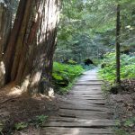
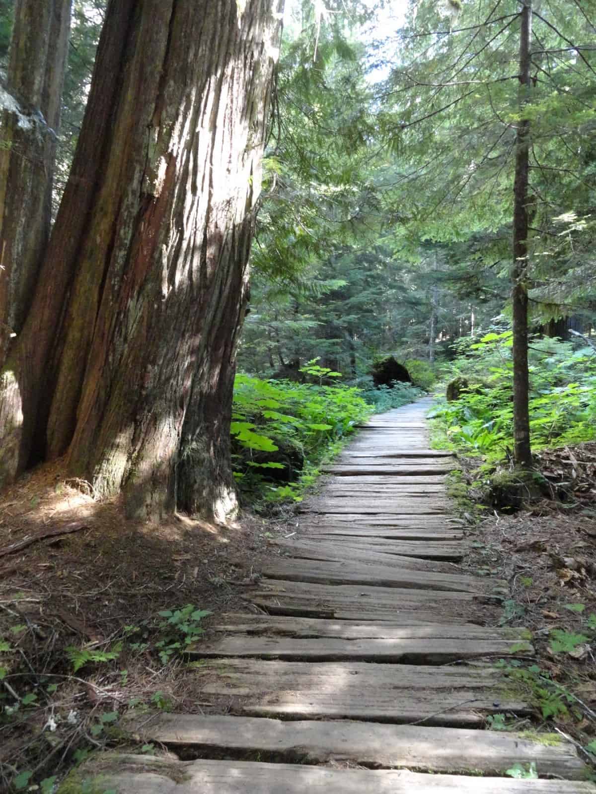
Immediately enter beautiful old growth forest and soon come to a junction. You want to go left carefully crossing the Longmire-Paradise Park Road and continuing on the Wonderland Trail north. On wide and well maintained trail, traverse beautiful groves of monstrous ancient firs and cedars. After walking across a series of boardwalks spanning a marshy area, begin climbing.
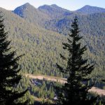
It’s a stiff little climb up Rampart Ridge. Occasional breaks in the forest canopy reveal views to Eagle Peak across the roaring Nisqually River. Eventually crest Rampart Ridge reaching at 1.8 miles the junction with the Van Trump Park Trail. The Rampart Ridge is an elongated ancient lava flow that originated from Mount Rainier. It is fairly broad and thickly forested. The Ramparts are a series of cliffs along the western reaches of the ridge. The Van Trump Trail travels 2.6 miles east along Rampart Ridge gradually climbing toward Mildred Point and Van Trump Park. This trail is an excellent choice for solitude and a longer more challenging hike. But it’ll have to wait until next summer as those higher destinations begin accumulating lots of snow come November.
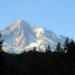
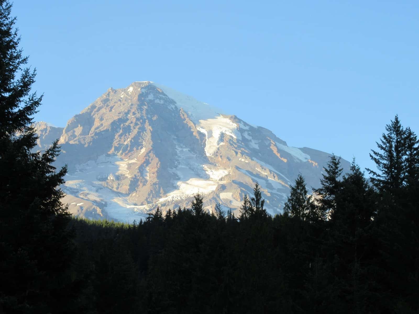
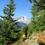
For the Rampart Ridge Loop continue left on the Wonderland Trail and at 2.1 miles reach the junction with the Rampart Ridge Trail. Now head left along the broad crest of the ridge passing a small wetland on your right. The bear grass line trail travels through thick forest interspersed with some tall trees. Enjoy easy walking gaining only about 200 feet in elevation in a little more than a mile. At 3.6 miles the trail breaks out of the forest to traverse an opening revealing a breathtaking view of Mount Rainier above the emerald Kautz Creek valley. The opening is adorned in vine maples that add brilliant colors in September and October. And check out the intricate stone work along the trail here—a testament to the craftsmanship of past trail builders.
After soaking up the views—and on a clear day some sunshine too, continue hiking. The way makes a gentle switchback skirting the 4080-foot high point of the ridge. It then slowly descends leaving the ridge crest. Pass a window view east of Tumtum Peak and come to a spur leading to an overlook of the Nisqually Valley. Years ago, this was an excellent view—but trees have grown in making it a more challenging vista. Perhaps a winter windstorm can someday topple a few of the obstructing trees to open things up again. In the meanwhile, be content with the limited view of Eagle Peak in the Tatoosh Range across the valley. Look up valley and locate the park road bridge over the Nisqually River. And look below making out Longmire’s historic structures.
Now continue on your hike descending the ridge on a wide path over a series of sweeping switchbacks. The trees become increasingly taller as you lose elevation. The forest is open and usually teeming with deer looking for forage. Pass impressive Douglas firs, big old pillars holding up the sky here. The way descends the ridge west of the Ramparts which unfortunately are not visible along the hike.
At 4.8 miles reach the Trail of the Shadows. This lovely interpretive trail makes a .7 mile loop around a wetland, hot springs and replica of James Longmire’s cabin. The shortest way to complete the loop is to go right—but feel free to incorporate this nature interpretive loop into your hike if you like. The way right skirts the wetland meadows where hot (more like tepid) spring bubble to the ground. Stay on the trail as this environment is fragile. You might be able to get a sneak peak of the Ramparts through the trees. Once you reach the end of the trail near the front porch of the Longmire Inn, you’ll get a good view of Rainier—and one that is simply stunning in the evening light. If you’re staying at the Longmire Inn, pull up a chair on the porch and grab yourself something to sip—and enjoy the evening show.
Notes: Dogs prohibited.
Contact: Mount Rainier National Park; https://www.nps.gov/mora/index.htm; (360) 569-2211
Maps: Green Trails Mount Rainier National Park 269S
Trailhead directions
From Elbe at the junction of SR 7 and SR 706, head east on SR 706 passing through Ashford and reaching Mount Rainier National Park at 14 miles. Continue west on park road for 6.5 miles to Longmire and trailhead parking near the Wilderness Information Center.
Trailhead facilities: privy, water, visitor center, park concession
– Craig Romano, is an author of more than a dozen hiking guidebooks including the newly released 100 Classic Hikes Washington (Mountaineers Books) which includes several hikes in and around Mount Rainier National Park.
Waypoints
| Starting Point: N46 45.011 W121 48.746 | |
|
Notable Waypoints: Rampart Ridge Trail junction: N46 46.021 W 121 48.519 Trail of the Shadows Junction: N46 46.45.021 W121 48.946 |
|
Q: Where’s the nearest place to stay that’s not too far from the trailhead?
A: The National Park Inn is open year-round and it’s the closest lodge to the trailhead at Longmire.