| Area: Enumclaw |
Hike Type: dog-friendly | Pass: no pass required |
| Distance: 2 mi RT | Duration: 2 hrs | Difficulty Level: moderate |
| Snow-Free: year-round | High Point: 1,800 feet | Elevation Gain: 1,000 feet |
-
- IMG 0423
-
- IMG 0393

-

- IMG 0425
-
- IMG 0407
-
- IMG 0400

-

- IMG 0394

Features: kid-friendly, dog-friendly, historic fire lookout site
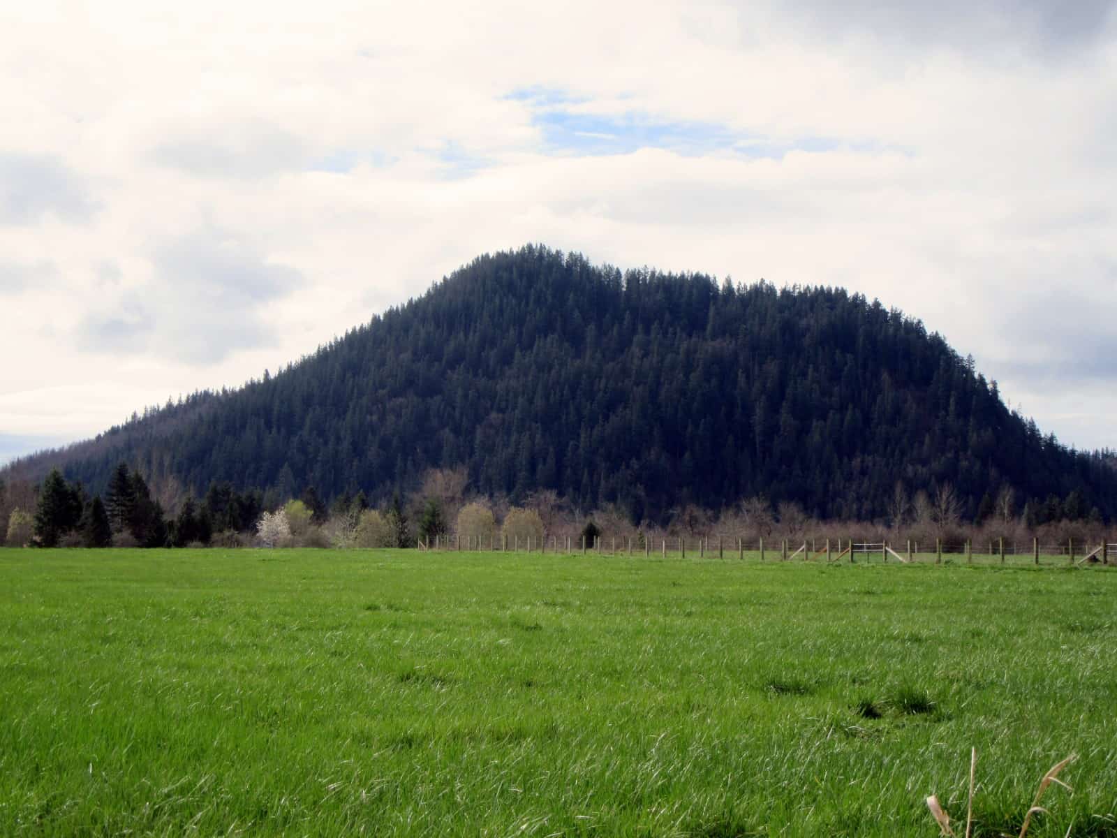
It’s a short hike but stiff little climb to this forested knob that rises abruptly out of the surrounding farmed flats just outside of Enumclaw. Once the site of a fire lookout, a contested name, and nearly logged of its old growth in the 1980s, this little peak has a storied past. It has an interesting geological story to tell too—being the remnants of an old volcanic cone.
Hit the Trail:
A well-loved local hiking spot, little Pinnacle Peak almost got the ax. Back in 1979 while being managed by the Washington Department of Natural Resources, this timbered knoll was slated to be logged. But public opposition led to it being transferred to King County and eventually made into a park. Today the 314-acre Pinnacle Peak Park is one of the most popular hiking destinations in south King County.
“Feeling grumpy? Want to be alone? Then don’t hike to Pinnacle Peak because if you are in a funk the hikers you’ll meet on this trail will raise your spirits whether you want them raised or not,” wrote the late beloved guidebook author Karen Sykes. You’ll meet hikers of all ages, sizes and abilities on this little peak. It’s not uncommon too to see area workers getting in a quick trail run; aspiring climbers with heavy packs using this peak as a training ground; or groups of hikers on fitness challenges or treasure hunts.
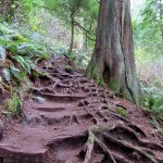
While this hike is popular, it’s not exactly a walk in the park. You’ll gain 1000 feet of elevation in just one mile on your way to the summit. And there are four ways to the summit, two from the south side and two from the north side. The most popular way is via the Cal Magnusson Trail, described here. From the Cal Magnusson Trailhead follow the well-built and well-trodden trail upward! The Goat Trail, the old way to the summit runs parallel with this trail. It’s steep with a few spots not advisable for children. If you are thinking about doing a loop, it’s best to go up the Goat and down Cal. The Magnusson trail can get a little muddy, but it shouldn’t pose any significant problems.
Pinnacle Peak’s most popular trail was named for a longtime mountaineer and REI employee. Young hikers will feel like they are traveling in this mountaineer’s footsteps as they tackle this peak. While the trail’s name is solid, this little mountain’s name, however, is not so set. Long known by locals as Mount Pete and Mount Peak (which is redundant, no?) it eventually became called Pinnacle Peak by King County Parks. You’ll hear folks describing this little summit by all three of these names. And a popular peak in nearby Mount Rainier National Park named Pinnacle Peak can cause more confusion.
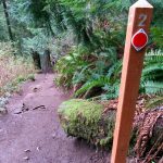
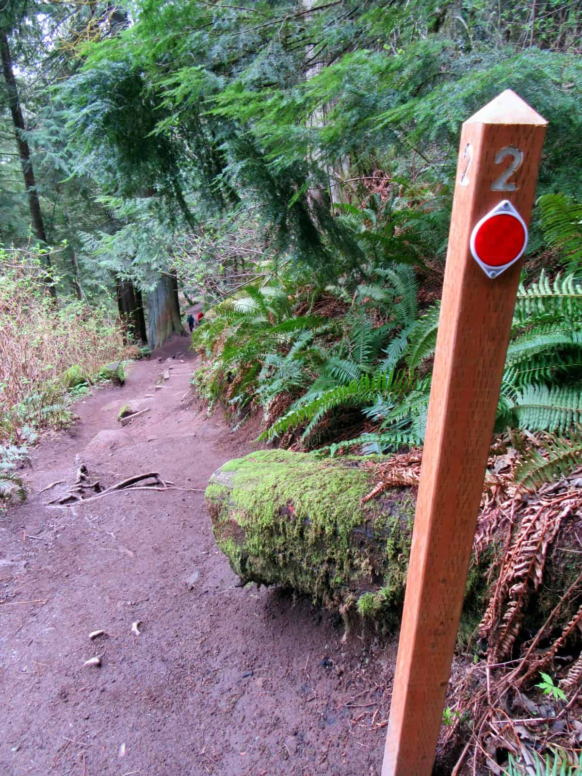
A series of numbered posts line the way. Kids will enjoy counting them as they make progress toward the summit. At about a quarter mile a short spur leads right to connect with the Goat Trail. Stay left and begin a long traverse across steep slopes. The way is shaded with big mature trees. A few breaks in the thick canopy offer window views to the farms and Enumclaw below. Near post 4 you’ll cross an old slide that can be slick. A cable provides for some stability. Pass another spur to the Goat Trail and at post 7 at around 0.8 miles the trail emerges on an old road. This is the old fire tower access road and it makes for a longer and somewhat easier approach from the south (trailhead located off of Mud Mountain Road).
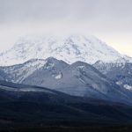
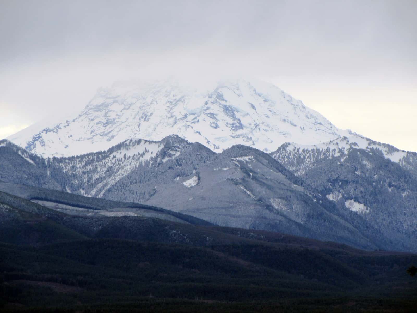
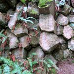
You want to follow this old road left. Now gradually ascending the way makes a switchback beneath a ledge of columnar basalt—further evidence of this peak’s volcanic past. The road trail wraps around just beneath the summit. Follow it as it leads to a view east over the White River Valley and to the Cascades foothills. A steep trail descends from the old road south and it can be followed a little over a tenth of a mile to a junction. Here you can hike right following a trail about .2 mile through thick timber back to the old road. While this loop option is a little tough—it does lead past a view of Mount Rainier.
Of course, don’t forget to take the short trail off of the old road to Pinnacle Peak’s 1800-foot summit. Yes, it’s anticlimactic with no views and its foundation blocks remaining from the fire lookout that was removed in the 1960s. But, there is always satisfaction in bagging a summit—so go claim it! Then find a good spot for a lunch or snack break and expect to meet a few new friends on this hopping with activity little mountain.
Notes: Dogs permitted on leash
Contact: King County Park
Maps: Available online from King County Parks
Trailhead directions: From the junction of SR 164 and SR 410 in Enumclaw, continue east on SR 410 for 0.8 miles to 284th Ave SE. Turn right here and proceed for 1.5 miles. Then turn right onto SE 472nd Street and continue 0.5 miles to trailhead on your left.
Privy at Trailhead.
– Craig Romano, is an author of more than a dozen hiking guidebooks including 100 Classic Hikes Washington (Mountaineers Books)
Waypoints
| Cal Magnusson Trailhead: N47 10.716 W121 58.424 | |
| Notable Waypoints:
Summit: N47 10.428 W121 58.402 |
|